Very few people know that St John’s Theological College in Armidale was, in fact, the first tertiary institution in the North. St John’s acted as a trigger for a post on my personal blog: Populating a landscape – writers and writing. This History Revisited post, History revisited – college a capital idea, tells a little of the early story.
Friday, May 23, 2014
Sunday, May 18, 2014
Journey to the Hunter – Saturday 19 April 2014: on to Morpeth
Continuing the story from Journey to the Hunter – Saturday 19 April 2014: St Patrick’s Singleton, we drove out of Singleton in the late morning on our way to Morpeth for a late lunch. I hadn’t been to Morpeth before, and had been wanting to go for years.
The first part of our journey took us along the newly opened Hunter Expressway towards Maitland. I am sure that it’s convenient, certainly it’s quicker, but it imposes its own blankness on the landscape. In fact, this was a problem for the whole trip. I knew the Hunter very well and had done so for many years. However, the new roads and the spread of the urban landscape in the Lower Hunter created a very special spatial dislocation as my mind warred between the scenes I saw now and my previous memories.
For those who don’t know the Hunter Valley, it’s 29,145 sq km (11,252.9 sq mi) in size. The population is over 620,000, of which the great bulk lives in the Lower Hunter. We left the Expressway to drive into Maitland. Founded in 1820, Maitland (more precisely West Maitland) was the second largest town in Australia until the gold rushes, acting as the main entrepot point for Northern New South Wales. Established in 1843, the Maitland Mercury is the second oldest surviving newspaper in Australia after the Sydney Morning Herald.
Maitland has many historic buildings, but this time we couldn’t stop. I wanted to get to Morpeth. Had we stayed on the main road, the signs would have taken us there. Me being me, I decided to try to follow the river, promptly getting lost. We ended up in a place called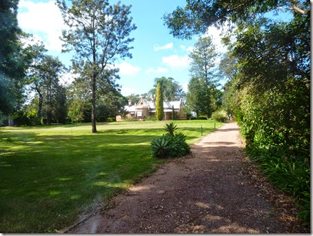 Bulwarra with some fascinating old buildings in the midst of the more modern houses. I had never heard of it,
Sadly my photos didn’t come out properly, but this will give you a feel. By now it was quite late, my companion wasn’t feeling well, and we needed to get to Morpeth to eat. I walked across the road and asked a woman for directions. She was very friendly. “I went to school here,” she said. “ I wanted to come back, but it took us a very long time to find a house. There just aren’t any for sale.”
She explained that the house we were looking at was indeed one of the original big houses built during the convict period. With directions, we drove on, coming into Morpeth across the river bridge.
I should now introduce Morpeth. It was founded around 1831 by Edward Close at the head of navigation on the Hunter River. Smaller craft could go on to Maitland, but Morpeth was the effective head of navigation. At the time Morpeth was established, the main connection between Sydney and the Hunter Valley lay over the difficult inland route. In 1825, convicts began building the Great North Road to provide a better connection. Finished in 1836, the road was a major engineering feat, However, by then technology had changed.
In May 1831, the Sophia Jane arrived in Sydney Harbour from England. the first working steamer to be seen in Sydney Harbour. Built by Barnes and Millar in 1826, she was 153 tons and had one engine of 50 horse power. Three years earlier in 1828, two experienced shipbuilders, William Lowe and James Marshall, had arrived in the Colony. Under the guidance of entrepreneur Sydney merchant John Hickey Grose they selected land on the bank of the Williams River at Clarence Town and by 1830 had set up a shipyard complete with a wet dock cawed from a convenient creek. After building a few small boats to get the feel of the local wood they laid the keel of the first Australian steamship, the 'William the Fourth, in early Feb. 1831.
These ships were small, but they transforme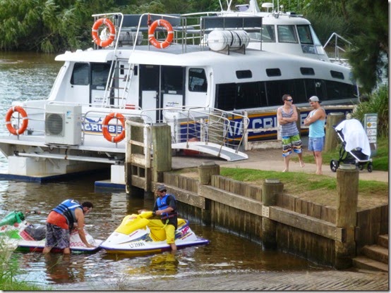 d trade. Sailing ships has struggled to travel the sometimes narrow and winding Hunter. Now goods and people could be carried with a degree of certainty al the way up the river to Morpeth and the main population centres, Morpeth grew rapidly.
Today, it is actually hard to imagine the bustling town and its busy river port. We unpacked the picnic basket on a spot overlooking where the main wharves had been. There is still river traffic, more than I expected, but it is all leisure craft now, We were both tired, so we sat there quietly eating bread and pate, cheese, olives with a glass of wine in hand watching the other picnickers.
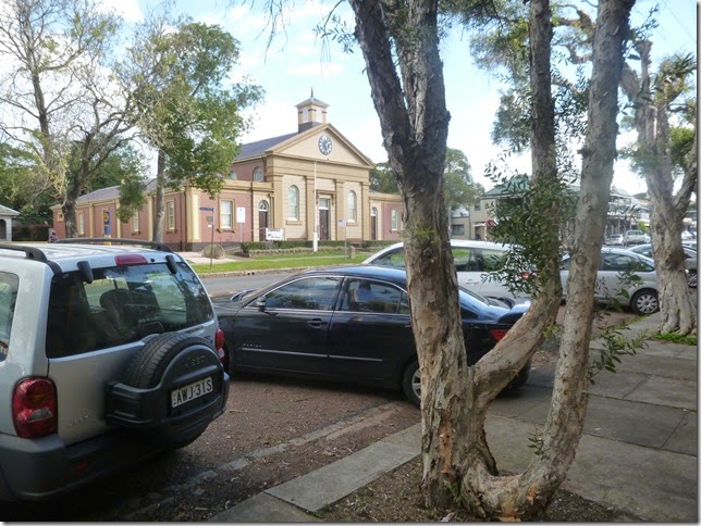
Packing the picnic basket, we drove back up the hill to find a place to park. The town stretches in a longish strip along the river bank, The buildings vary in age, with the usual mix of domestic and the monumental you might expect from the town’s previous importance. This is the old court house.
And this is an example of one of the older buildings.
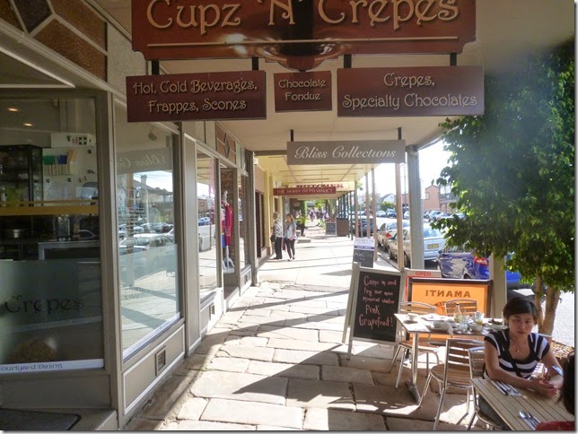
And this will give you a feeling for the screetscape in the town centre. Cupz and Crepes is, we were told, currently the most fashionable locale in Morpeth!
Morpeth was packed with tourists there for the Easter Weekend.  Feeling tired, we joined the queue to find a spot for coffee looking down towards the river. It was time to return back to Pokolbin and dinner.
The drive back gave me something of the same feeling of disconnect that I had had in the morning. I wanted to go a different way home, but found myself driving through miles of suburban sprawl.
Then came dinner at the resort. Because it was a holiday period, they added a 15 per cent price premium. Later, I saw a sign at reception advising of this, but it wasn’t on the menu nor signed in any way at the restaurant. We wouldn’t have minded so much if the food was good, but it was the worst cooked steak I have ever eaten. It was horrid!
I was annoyed. It cast a damper over what had, in fact, been a very good day.
For those who want to follow along with the story, you will find the entry point for all the posts here.
Sunday, May 11, 2014
Journey to the Hunter – Saturday 19 April 2014: St Patrick’s Singleton
Continuing the story from Journey to the Hunter – Saturday 19 April 2014: Broke Fordwich, we left the mines behind and drove down the Putty Road to Singleton through the bright morning sun. Singleton has changed so much as a consequence of the mining boom that the very pattern of the streets seems different. Still, I knew where I wanted to go.
Last year I read Michael Sternbeck’s history of the Catholic Ch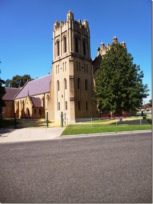 urch In Singleton: The Catholic Church In Singleton: an historical look at its people and progress (published by the author, c1981.) Now I wanted to visit the church complex with its church, convent and schools.
The buildings lie on a quite narrow strip donated by John Browne. Browne, originally just Brown, was a prominent lay person whose donations helped fund much of the early development of the Church in Singleton.
The photo shows the Church. The towers themselves were added in 1920-21. The building behind dates from 1859-1860, In March 1859, Archbishop Polding laid the foundation stone. In February 1860 he returned to open the building.
Both the church and the buildings around it have grown by accretion over the years. I wandered trying to work out what was what. Actually, it wasn’t easy. I didn’t have the history with me, so wasn’t sure just which building was what. Slowly, a pattern started to form. Meantime, my friend had vanished to do her own thing.
I wandered around the corner after her, finding that most valuable of things, a a toilet. Normally shut except during services, it was open that day because the church was being prepared for Easter Services. The side door was open, so I wandered inside, finding my friend standing watching a group of women preparing flowers.
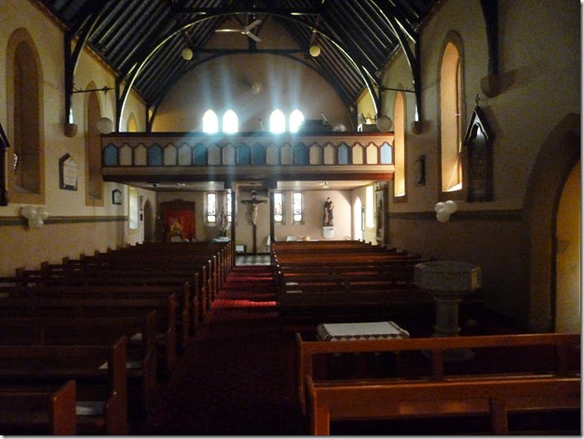
It is a truly Beautiful church. This is the view in the old church looking towards the front door. The gallery you see was built in 1874-75 at a cost of 366 pounds.
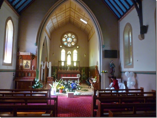
Looking forward in the church, you can see the flowers being prepared for the Easter Service. On the left of the photo, a later extension provides a private area where the Sisters of Mercy from the Convent can participate in services. A quiet covered way links the extension with the Convent.
It was peaceful, but we had to move on. Next step Morpeth, and the vibrant world of commerce in the first half of the nineteenth century.
For those who want to follow along with the story, you will find the entry point for all the posts here.
Sunday, May 04, 2014
Journey to the Hunter – Saturday 19 April 2014: Broke Fordwich
Breakfast over. we headed back to the little village of Broke. Given my companion’s cold, we needed to stop at the little general store for supplies and especially bottled water!
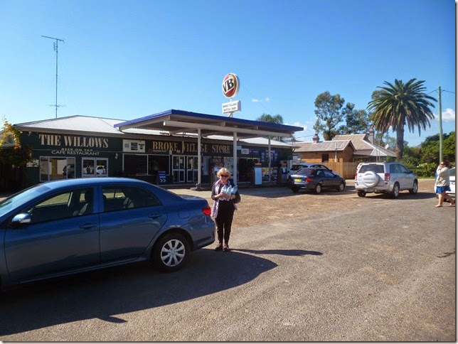
While water was being gathered, I wandered across the road to the little war memorial. Your find these in all Australian country towns, but this one was more domestic, less monumental, than most. 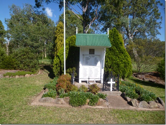
Broke lies on Wollombi Brook. Marked yellow on the map, Wollombi Brook rises below Mount Warrawolong in the Watagan Mountains. Starting at an elevation of 426m, it flows north-east for 118km before joining the Hunter River, dropping 378m. Our journey to the Hunter the day before (Journey to the Hunter – Friday 18 April 2014: the adventure starts) had tracked the Brook and its little villages. There is some beautiful country with many byways, although this time we were just travelling through to Pokolbin. 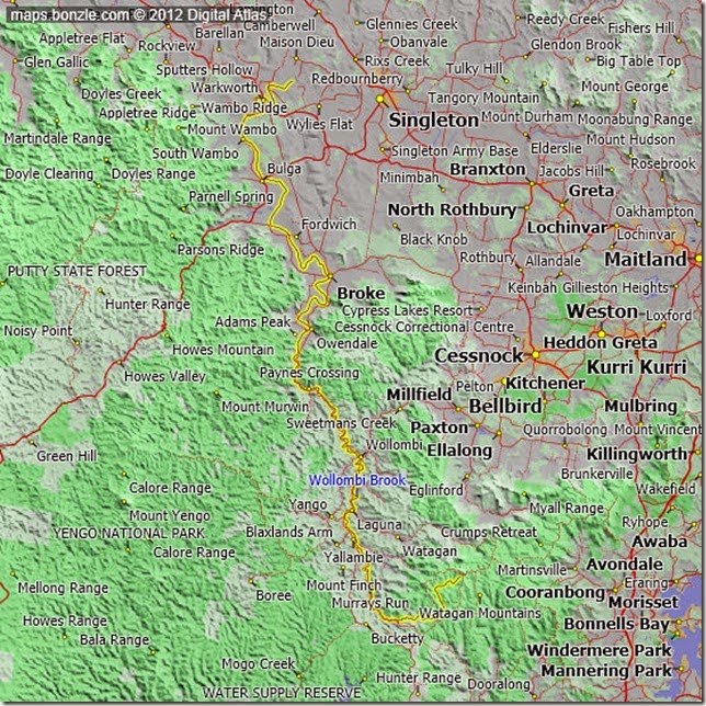
I had wanted to visit the Broke Fordwich region for a number of reasons. One was the desire just to see the place, a second to see for myself the changes that were taking place, including the conflict between agricultural and industrial activities.
When I first started driving between Armidale and Sydney or Canberra, I drove the Putty Road. That’s the red line on the top left of the map, heading south west from Singleton through Bulga and Howes Valley to Windsor on the outskirts of Sydney. Later, I discovered the Wollombi-Broke Road, the road tracing the course of Wollombi Brook. This was considerably shorter, but included long stretches of often dusty dirt/gravel roads. I grew up driving on dirt roads and liked them, leaning how to navigate the mix of potholes (go slow) and corrugations (go fast), how to manage the loose gravel or dirt that could easily cause the car to spin. Mind you, it wasn’t necessarily good for the car, with the flying gravel effectively stripping the lower paint away.
At the time I first drove these roads, this was an area frozen in time. Its period as the main route north was long gone, quickly replaced by cheaper sea and river transport to Morpeth on the Hunter. This freezing in time effect had preserved many of the older buildings, the early historical framework, making for an interesting drive.
This was now to change. In 1963, Dr Max Lake established Lake’s Folly, the first of the new boutique wineries in the Hunter. In 1968 or 1969, I have seen both dates us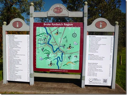 ed, Len Evans established Rothbury Wines. In that year, Graham Kerr launched his Galloping Gourmet TV program. The age of fine dining, the extravagant four bottle business lunch of the 1970s, was dawning.
The start of the 1980s saw the explosion of what would come to be called the sea change/tree change phenomenon. As part of this, boutique wineries spread across the Hunter, finally spreading to the quiet Wollombi Valley. With this came new agricultural activities and food stuffs, including especially the now ubiquitous olives. Then came the resorts.
The scale of all this is illustrated by the photo of the Broke Fordwich tourism display. You won’t be able to read the names; the significant thing is the just the number. None of this existed when I first drove through Broke all those years ago.
The area retains its natural beauty. This is illustrated by the following photo, a pastoral scene of black Angus cattle with the Broken Back range in the background. The wineries have added further texture to this beauty. 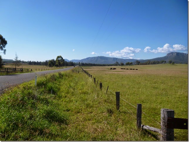
Aeons ago, a shallow inland sea existed in what is now called the Gondwana Supercontinent. There coral and other animal or plant stuff formed deep sediments. As Gondwana was torn apart by huge geological shifts, those sediments were covered and transformed, finally forming extensive coal deposits. Today, we call this the Sydney-Gunnedah-Bowen Basin.
The next shows< think, the Warkworth open cut coal mine just to the north of Broke on the other side of the Putty Road. There are, in act, two mines. The first is the Warkworth Mine north of the Putty Road. On the other side, you have the Mount Thorley mine running down towards Broke. Both mine are run as one by Rio Tinto subsidiary Coal & Allied Industries. The little village of Bulga on the Putty Road lies between them.
The photo shows the sheer scale of industrial activity. Those coal trucks at the bottom left of the photo are clearly big, but you only really get a feel for their size if you let your eyes stand back a little and look at them against the scale of the mine. They really are big. Further comments follow the photo. 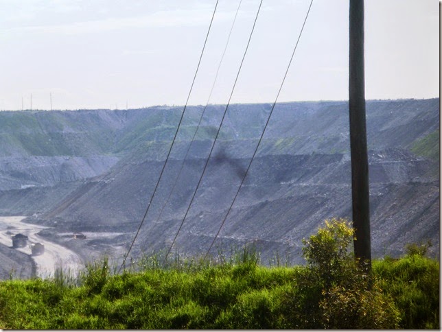
As a New England historian, I am interested in the role that King Coal has played in New England history. There is an untold story here of national significance that I am only just coming to grips with. That was part of the reason for this trip. As an economist. I am interested in the economic aspects of coal development. As a traveller and somewhat one-eyed New England patriot, I am interested in the current impact and what it means for the future.
Warkworth vs Bulga is a hot current story, part of the environmental wars that have swept Northern NSW, my broader New England. Should the mine be allowed to expand if it threatens, as it does, the very survival of Bulga as a village and the beautiful country around it? That is the key issue in current court cases and political activism in the area.
I will leave the story of our trip here, continuing in the next instalment.
For those who want to follow along with the story, you will find the entry point for all the posts here.
The history of sport in New England
My latest History Revisited column is on surfing: History revisited – how an era began. That reminded me that I need to do something about pulling together the limited writing I have done on the h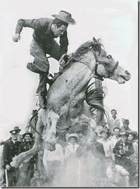 istory of sport in New England.
To this point, the posts are:
- 19 August 2011 A visit to a Cessnock boxing tent
- 13 October 2011 The importance of tennis
- 30 October 2011 Grafton to Inverell cycling classic turns 51
- 10 July 2013 History Revisited - our love affair with racing
- 21 August 2013 History revisited - rhyme and reason for bicycle mania
- 4 September 2013 History revisited - punching sky high for big dreams in region – boxing
- 3 October 2013 History revisited - New England rode high in rodeo past
- 30 April 2014 History revisited – how an era began surfing
- 28 May 2014 History revisited – remnants of a past era – side saddle
I will try to add to this post as I go along.
